Denver city’s public transit directions had now been introduced by Apple for their iOS and OSX users which are in continuation of the supports slow expansion. The residents of Denver can now find their way through the light rail systems and buses of the city with the help of the Apple Map.
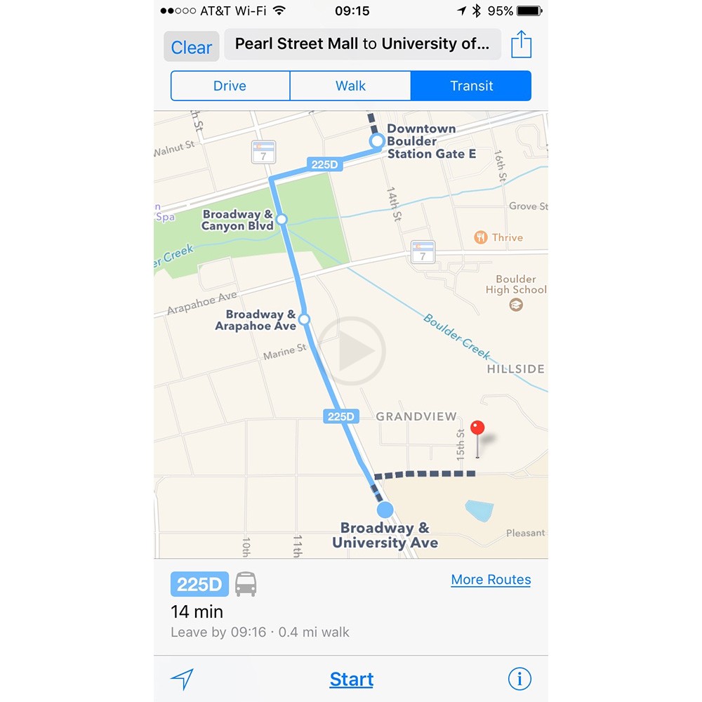
Like always, the various transportation methods would be mixed and matched to suit the user’s needs and optional route information will also be provided if there are various ways to get to particular place. Even in the case if the user would need to make multiple changes, the necessary information will be provided so that the user gets to their destination easily.
When the iOS9 was released in 20015, the transit direction to Maps had been restored by Apple after it had been taken out in iOS6, and now it seems to be that the service is growing very slowly. The cities that Apple mostly supports are the ones that are located in China and U.S.; however, there are still some significant gaps that are still there within the home country itself.
Throughout 2016, more locations have been gradually added by Apple. Cities like Rio de Janeiro, Montreal, Miami, Atlanta, New South Wales Australian state and even a few regions that the U.K. National Rail services are part of the recent additions that have been made.
The feature guide of iOS9 with the recent changes is yet to be updated however, behind the actual support; there has been a lag that has been noticed. By the time the launch of the iOS10, the company hopes that more transit directions which are comprehensive should be done. While this fall, the iOS 10 is said to make its availability to the public, presently the first beta for developers is under running.